
Energy maps publisher GreySellsGlobal announce the release of their brand-new energy map covering the Northwest Europe Offshore Energy Resources, topically and timely, Tracking The Transition.
The Northwest Europe region is undergoing a massive transition away from fossilised fuels towards renewable ‘green’ energy sources and a carbon neutral footprint. Over many years, since the first oil and gas fields came on stream, many sources have tracked this activity and released it in many forms. GSG have, for over 35 years, charted this activity and released it as wall maps, image files and within GIS mapping applications.
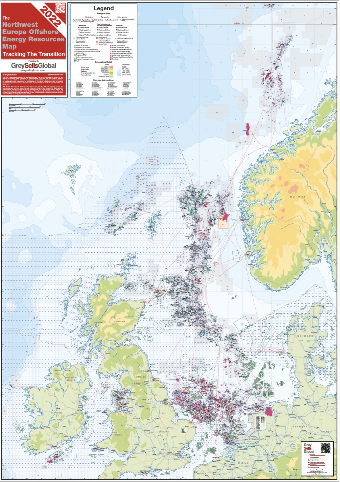
Now it is time to re-look at the broader Northwest Europe offshore energy sources, combining all the established (and producing) oil and gas fields, the fields with future potential to come on stream with proven reserves, in conjunction with the fast-emerging offshore renewables activity of wind and wave projects, the locations of new carbon capture projects and the establishment of hydrogen production and storage hubs.
This new energy map clearly reflects the present hydrocarbons offshore energy sources and the new green technologies coming into play. The map has brought together all the following features:
Regions Covered:
- UK, Norway, The Netherlands, Denmark, Germany (North Sea), Ireland, NW France and Belgium.
Offshore Energy Sources Featured:
- Oil and Gas
- Renewables
- Carbon Capture and Storage Projects
- Hydrogen Hubs
- Wave Energy Sites
Topical Energy Sources Data Featured
- Operational Oil and Gas Fields with Operational Production Facility Type (e.g. Fixed Platform, Floating Production or Subsea Tieback)
- Oil and Gas Non-Producing Fields (as-yet no production or export facility installed)
- Depleted fields and decommissioned infrastructure status
- Shut-in production facilities.
- Wind Farms locations and current operational status (Operational and Possible) including ScotWind awards areas
- Wave Energy project locations and names
- Carbon Capture & Underground Storage projects and names
- Major Hydrogen projects and names
- Offshore Exploration and Development Licence Areas with Operator Name, Block Name / Number and Status (currently operated or licenced, or open block status)
- Well locations
- Pipelines – Operational and Future
Available to order as hard copy wall map, high resolution digital map image or as GIS mapping file formats.
About GreySellsGlobal
Aberdeen based GreySellsGlobal offer over 35+ years of experience in the generation and publication of regional offshore activity and forecast maps for the energy sector.
Further services include: GIS mapping, Offshore Project Data, Regional Reporting and Business Strategy Support covering all energy and marine sectors – visit: greysellsglobal.com